Navitel Navigator 11 stands out as one of the most popular offline GPS navigation apps, featuring detailed maps covering 67 countries and territories worldwide. With a user-friendly interface and the ability to operate entirely offline, it's the perfect solution for travelers looking to save on roaming charges and remain unaffected by poor connectivity in remote areas. Enjoy a 7-day free trial to experience its full potential.
Advantages
- Modern User-Friendly Interface: Designed for ease of use, ensuring a seamless navigation experience.
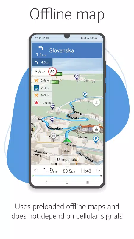
- Offline Maps: No internet connection is required, allowing you to save on roaming costs and remain independent of network quality.
- Highly Detailed Navigation Maps: Comprehensive maps that provide all the information you need for your journey.
- Voice Search: Find your destinations effortlessly with voice-activated search functionality.
- Convenient POI Search: Quickly locate Points of Interest by category, making your trip planning simpler.
- Visual and Voice Guidance: Receive clear visual and voice instructions to guide you along your route.
- Real-Time Road Information: Stay updated with road warnings, speed cameras, and restrictions to ensure a safer drive.
- HUD (Head-Up Display): Enhance your driving experience with a head-up display feature.
- Extensive Map Coverage: Access detailed maps for 67 countries and territories, available for purchase.
Special Features
- Fast Route Calculation: Navitel Navigator 11 offers quick and efficient route calculations for any journey.
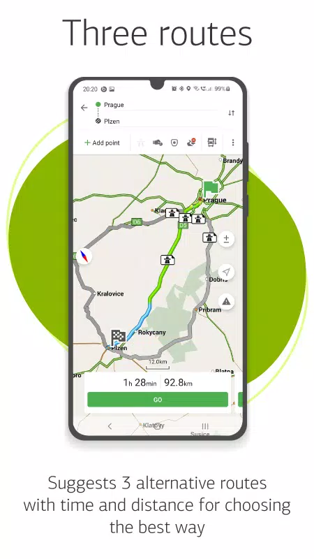
- Alternative Routes: Choose from three different routes, each displaying distance and estimated travel time.
- Navitel.Traffic: Get real-time traffic information to avoid congestion and save time on your travels.
- Navitel.Events: Be informed about road accidents, construction, speed cameras, and other events reported by the community.
- SpeedCam Warnings: Stay alert to speed cameras, video recording devices, and speed bumps on your route.
- 3D Mapping: Experience detailed three-dimensional maps with texture and multi-level support.
- 3D Road Interchanges: View complex road interchanges in 3D for better navigation.
- Lane Assist: Receive guidance on which lane to use, especially helpful in multilane traffic scenarios.
- Turn-by-Turn Voice Guidance: Navigate with ease thanks to clear voice instructions along your route.
- Cargo Graph: Plan routes specifically for heavy vehicles, considering road signs and vehicle parameters from 3.5 to 20 tons.
- Dynamic POI: Access up-to-date information on fuel prices, movie showtimes, and more, directly from your navigation system.
- Unlimited Waypoints: Plan complex routes with the flexibility of adding an unlimited number of waypoints.
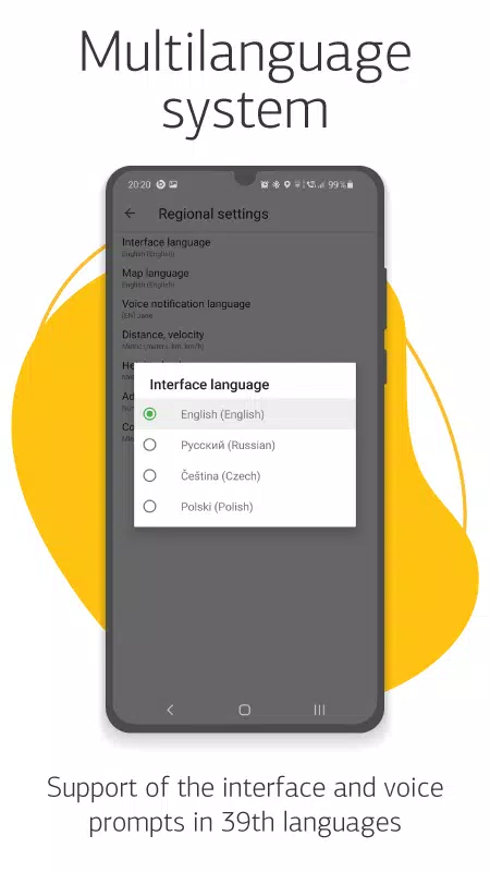
- Multilingual Support: Navigate in your preferred language with support for 39 languages.
- Customizable Interface: Tailor the app's interface and map display to suit your personal preferences.
- In-App Purchases: Easily buy new map packs or renew existing ones directly from the app's menu.
- Multitouch Support: Utilize multitouch gestures for quick map scaling and rotation.
- Dual Navigation Systems: Benefit from the combined power of both GLONASS and GPS for enhanced accuracy.
For any inquiries or assistance, feel free to reach out to our support team at [email protected]. We're here to help you make the most out of your navigation experience.