City routes, live traffic, transit routes, parking, offline maps, and navigation—2GIS has you covered with all your urban exploration needs. We're excited to announce that we've updated 2GIS to showcase the vast amount of information we've gathered about cities and companies. The new version of our app features a refreshed design, an enhanced search function, improved city updates, and a seamless integration of favorites with 2gis.ru.
Services, Addresses, and Companies
With 2GIS, you can easily find out which service provider is operating in your building, locate the nearest district hospital, or find the closest post office. Our app helps you choose cafes or service centers based on real user reviews and photos, and provides essential information like opening hours and contact numbers.
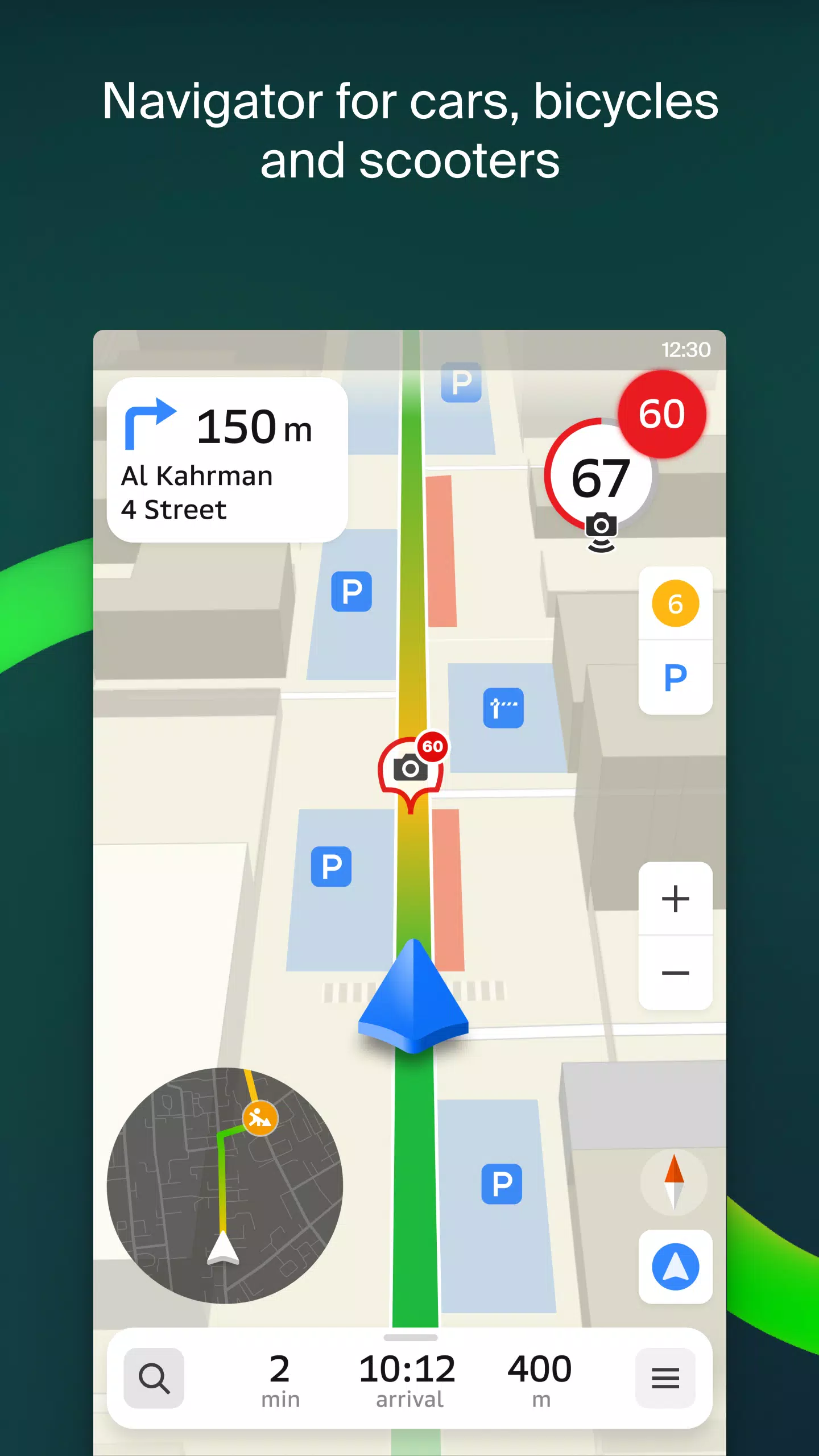
Transport and Navigation
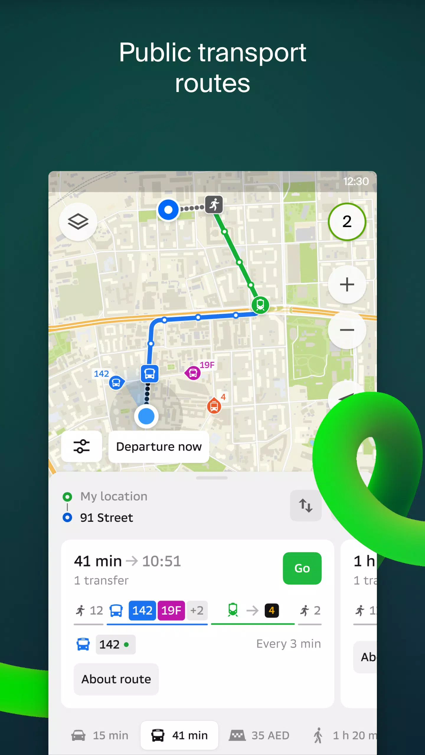
Whether you're driving or walking, 2GIS offers robust navigation features. For drivers, our app provides turn-by-turn voice guidance, taking into account traffic jams and road closures. It dynamically updates your route if you deviate from the planned path. For pedestrians, 2GIS offers multiple transit options, including buses, metro, trains, cable cars, and river trams.
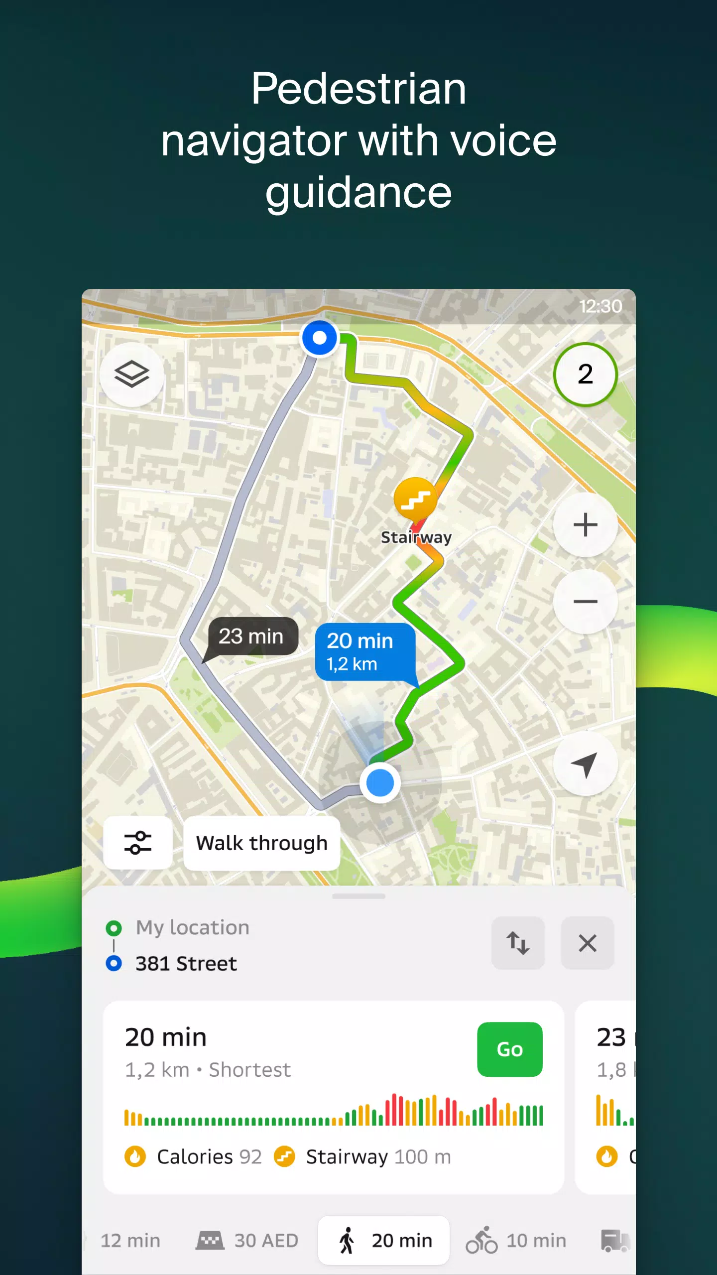
Walking Routes
Our pedestrian navigation system charts the most efficient routes for you to walk, offering background operation and voice guidance for a seamless experience.
Friends on the Map
Stay connected with your loved ones through 2GIS. You can now see the real-time locations of your friends and family on the map. Control who can see your location and manage your visibility settings effortlessly.
Building Entrances
No more wandering around to find the right entrance. 2GIS knows the entry points for over 2.5 million companies, guiding you directly to the door, whether you're using public transport or driving.
Plans of Shopping Centers
Navigate shopping centers with ease using 2GIS. Our app provides detailed maps showing everything from stores and cafes to ATMs and restrooms, helping you plan your visit in advance to save time.
2GIS Beta Notifications Companion App for Wear OS
Enhance your navigation experience with our beta Notifications companion app for smartwatches on Wear OS. This handy tool allows you to view maps, receive maneuver hints, and get vibration alerts as you approach turns or your destination bus stop. The companion app automatically starts when you initiate navigation on your phone and is compatible with Wear OS 3.0 and later versions.
As a beta tester, you'll receive updates as we fix bugs and errors, contributing to the development of a new version of 2GIS that will benefit millions of users. You can run both the original and beta versions simultaneously, switching between them at any time.
For support, reach out to us at [email protected].
What's New in the Latest Version 6.44.1.559.3
Last updated on Oct 19, 2024
We're thrilled to roll out beautiful, crisp updates tailored just for you:
- We now showcase wide, realistic roads on the main map and during route searches.
- Introducing the much-anticipated Chats for Friends! Stay connected and message each other without leaving the map.
- Added notifications when a friend is nearby (which you can toggle off in settings).
- Just in time for ski season, we've added ski lift statuses on slopes, so you can see if they're open or not.
- For public transport routes that include walking, we now calculate the walking part in steps.