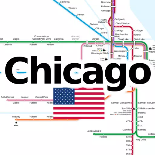
All important subway- and railroad maps of Chicago in one application.
Discover the essential offline maps for Chicago's transit system with ease. Our app provides comprehensive, zoomable maps for both locals and tourists to navigate the city's transit networks effortlessly.
The following line networks are available offline without any additional download:
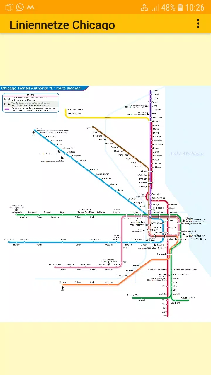
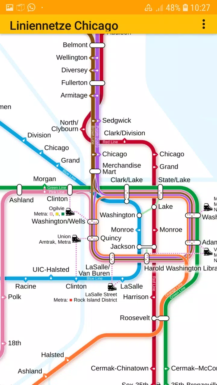
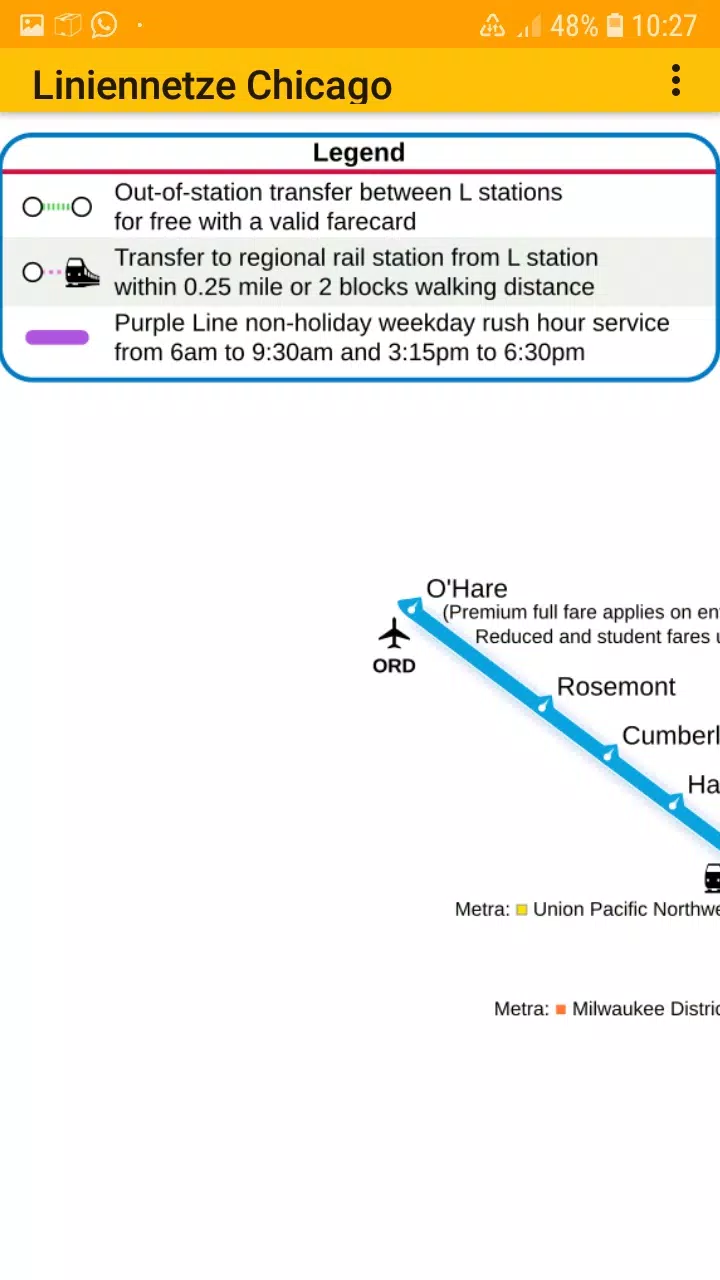
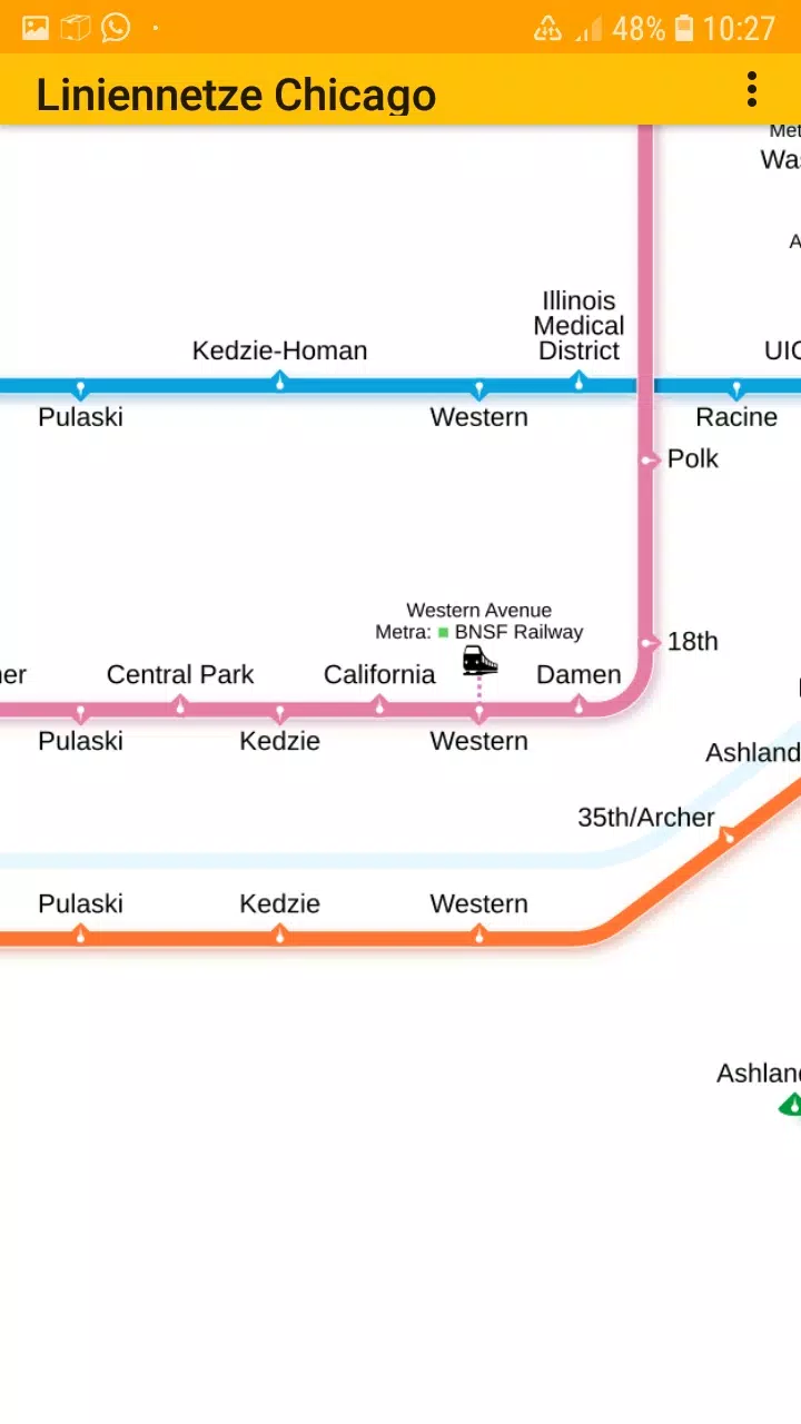
• Chicago elevated „L“ rapid transit system
Stay connected with us on:
- Facebook: https://www.facebook.com/203994253076876
- Homepage: https://dieeinsteiger.blogspot.com
Our easy-to-use app features simple, scrollable maps that allow you to zoom in and out as needed. With multiple tabs, you can switch between different types of transit maps effortlessly.
The metro line network, also known as the underground, rail transit map, urban tube map, or public subway, is included for a complete transit experience.
We value your input! Feel free to send suggestions for improvement, ideas, wishes, or feedback via e-mail or through the contact form on our website: https://dieeinsteiger.blogspot.com/p/kontakt.html
Notices:
• Compatible with phones and tablets running Android 4.4 (KitKat, API 19) to Android 13.0 (API 33).
• Please note that the app's content is not guaranteed to be accurate or complete.
• The maps embedded in this app are subject to the Creative-Commons license (CC BY-SA 4.0) and were created by Chinese Wikipedia user Sameboat, the copyright holder.
Enjoy exploring Chicago's transit system with our app, available on the Google Play Store, brought to you by dieEinsteiger.
What's New in the Latest Version 1.3
Last updated on Oct 20, 2024
v1.3 (06-08-2024)
- Updated to Android API 35 for enhanced performance and compatibility.